|
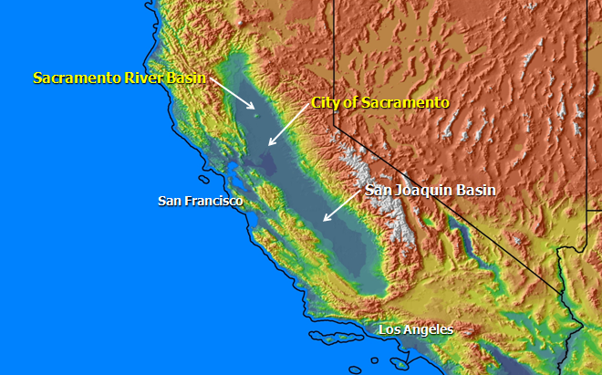
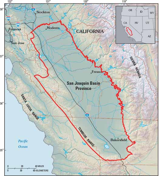
The San Joaquin Basin
The San Joaquin Basin, is a sediment-filled depression, that is bound to the west by the California Coast Ranges, and to the east by the Sierra Nevadas. It is classified as a forearc basin, which basically means that it is a basin that formed in front of a mountain range.
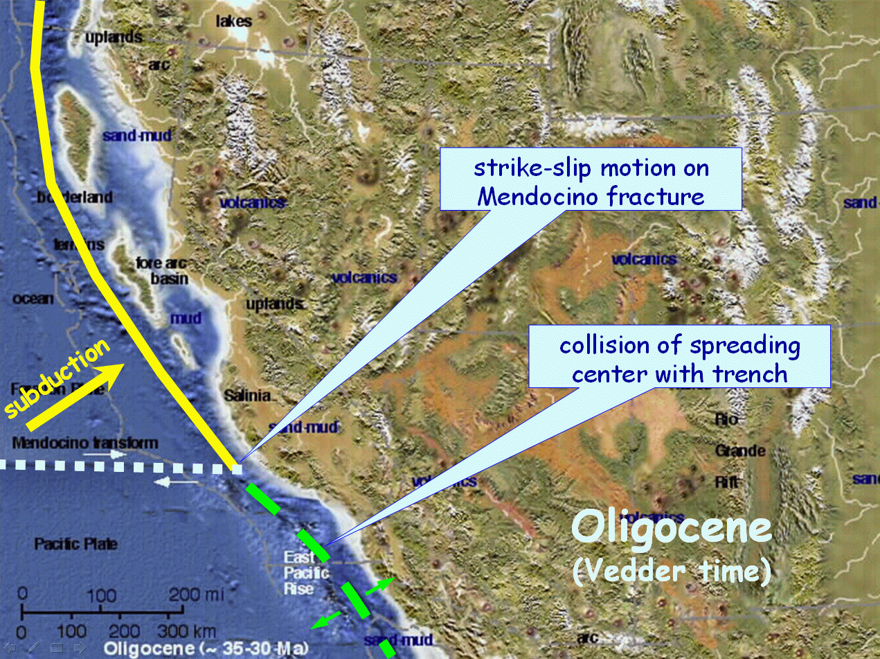
The Basin dates back more than 70 million years ago to the Mesozoic, when subduction was taking place off the coast of California. However, the plate tectonic configuration of western North America changed during the Tertiary, and the ancient trench that once characterized offshore California was transformed into a zone of right-lateral strike-slip motion that we know today as the San Andreas fault. Nonetheless, the Valley still retains many features that characterized it prior to formation of the San Andreas transform. A shallow and ancient ocean once existed here and the only fingerprint that remains is this basin which it left behind. Because of this the San Joaquin Basin is literally saturated with Oil and Gas reserves. The shale zone underneath the basin has been identified as the Monterrey Shale. Since the the beginning of production in this basin the shale was inaccessible and unproducible because of technology at the time; however because of new technology coming out of the drilling fields of Texas in the Barnett Shale this Monterrey zone now becomes a slam dunk in natural gas homeruns for the drilling industry.
Oil, Gas, & Mineral Lease 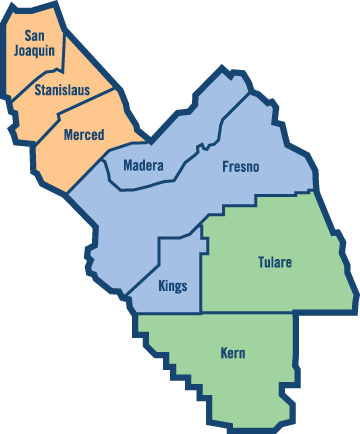 Do you have mineral rights in these counties? Do you have a Mineral Deed or a Warranty Deed? Would you like to see if there Oil or Gas under your property? contact: The County Landman
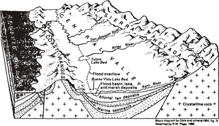
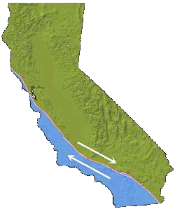
The tectonic processes by which this arc-trench gap formed are complicated, as are the events by which the ancient trench became the San Andreas fault. 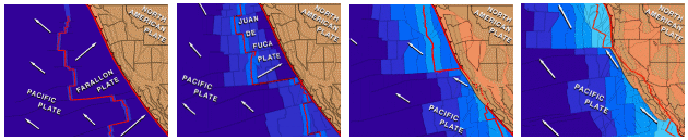 When the San Joaquin Valley first formed it was an inland sea between two mountain ranges. This configuration remained even after formation of the San Andreas fault (below). However, as the volcanic cover of the Sierras was eroded off, the resulting sediment was dumped into the Valley below. At the same time, The Coast Ranges were also being worn down and dumped into the valley. Thus, the inland sea was filled to create the continental basin we know today.
When the basin was still an inland sea, diatoms and other plankton thrived in it, and when these organisms died they accumulated on the basin floor to create shales which are rich in organics this includes the Eocene Kreyenhagen, and Miocene Monterey Formations. The integrated effects of heat and time then acted on the buried organic matter within these shales to create oil, and the detritus eroded from the Coast Ranges and the Sierra Nevadas provided reservoir rocks where the oil and natural gas could accumulate.
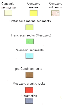
PaleogeographyThe paleogeography of the San Joaquin Valley
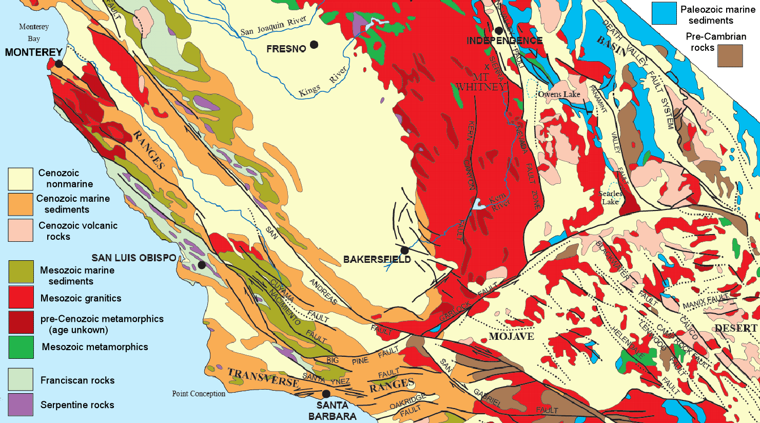
Geologic Map of the San Joaquin Basinclick on the map to
view a more detailed version
Do you have operations, land,
or minerals over the Permian
Basin?
DRILL YOUR RETIREMENT IN THE NATURAL GAS SHALE
BASINS
ANADARKO BASIN
|
APPALACHIAN BASIN |
DENVER
BASIN |
FORT WORTH BASIN
SHALE PLAYS
BAKKEN SHALE
|
BARNETT SHALE |
HURON SHALE
|
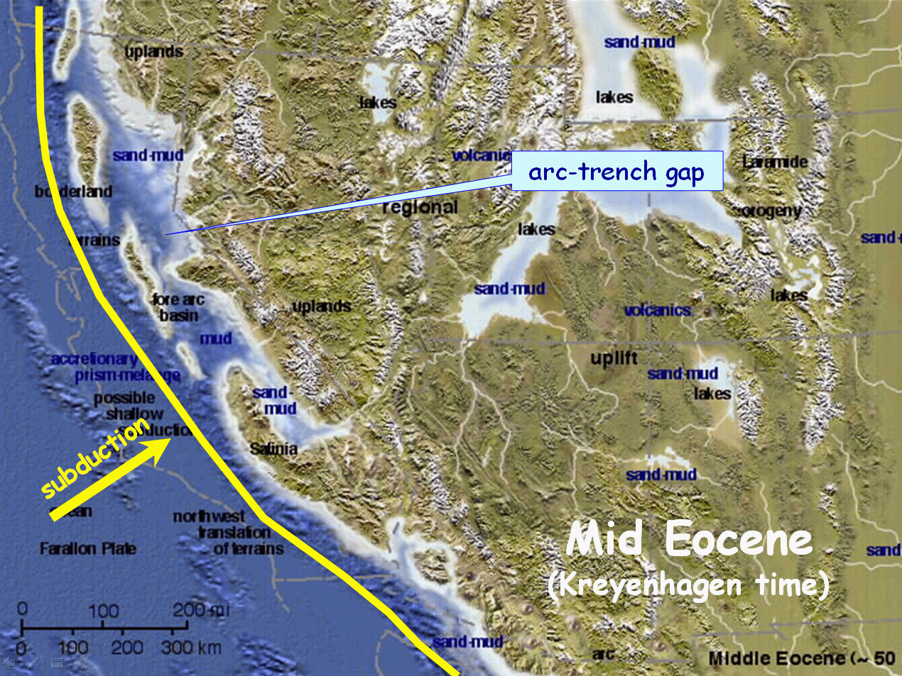
 Because the San Joaquin Valley is bound to the west by the
California Coast Ranges, which represent a zone of folding and
thrusting (i.e., an accretionary prism) associated with the ancient
subduction zone, and bound to the east by the Sierra Nevadas, which
represent the eroded roots of an ancient volcanic arc that was also
associated with the subduction zone, some call the valley a remnant
arc-trench gap.
Because the San Joaquin Valley is bound to the west by the
California Coast Ranges, which represent a zone of folding and
thrusting (i.e., an accretionary prism) associated with the ancient
subduction zone, and bound to the east by the Sierra Nevadas, which
represent the eroded roots of an ancient volcanic arc that was also
associated with the subduction zone, some call the valley a remnant
arc-trench gap.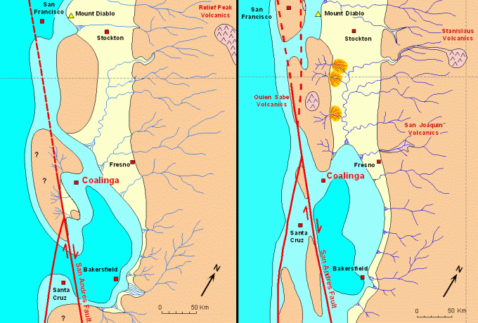
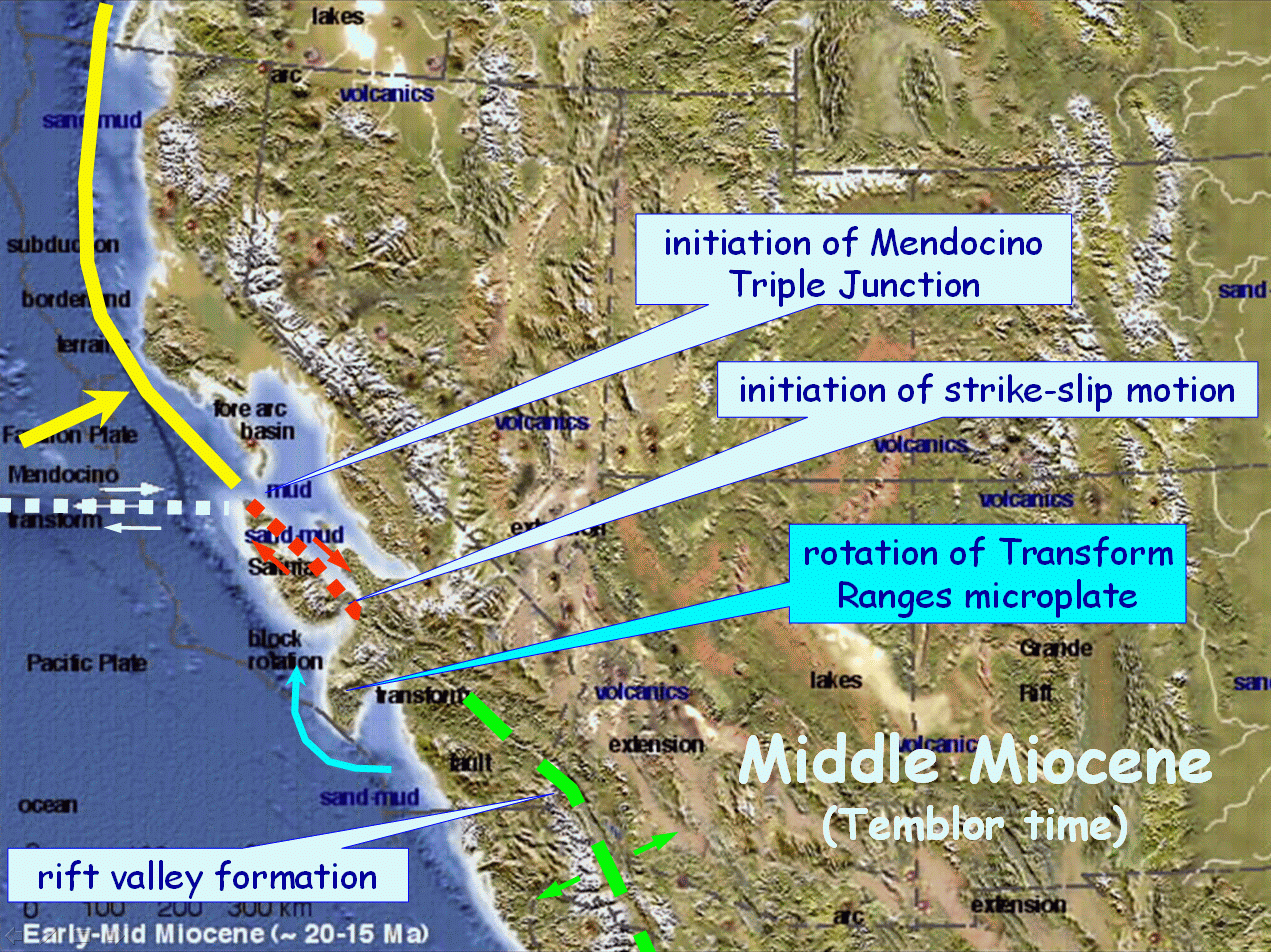
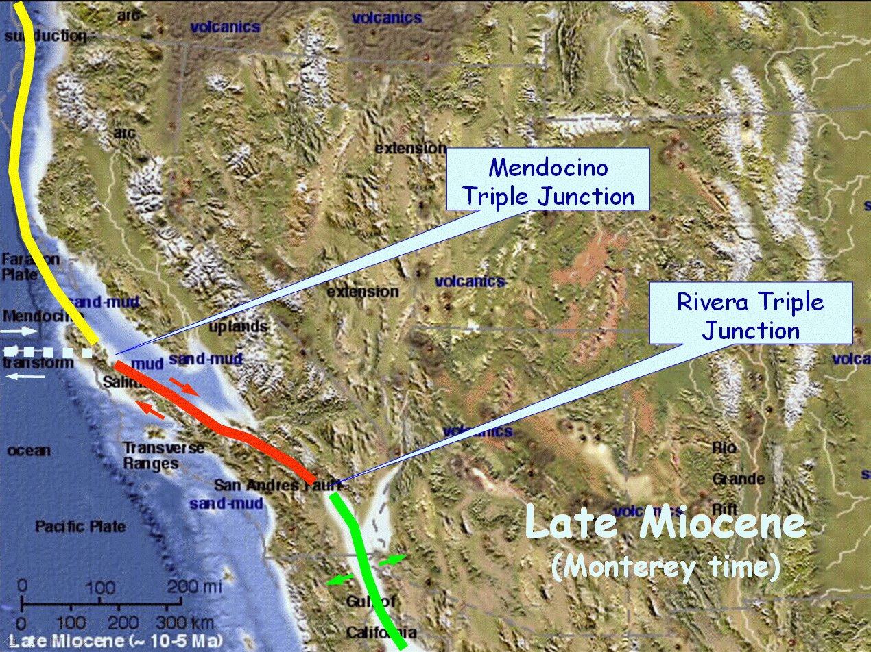
 The maps above show the San Joaquin basin during the middle Miocene
(left) and the late Miocene (right) when the principle source rocks
were deposited. From these source rocks most of the oil in the
valley is derived.
The maps above show the San Joaquin basin during the middle Miocene
(left) and the late Miocene (right) when the principle source rocks
were deposited. From these source rocks most of the oil in the
valley is derived.